Overview
History of Surveying in Japan
Uenishi Katsuya

Overview
History of Surveying in Japan
Uenishi Katsuya

Preface
The history of surveying in Japan is divided into four periods; 1) from ancient times,when feudal manors were developed by temples and loyal families, to the mid-19th century in the late Edo period, when map surveyors and cartographers such as Ino Tadataka emerged; 2) after the Meiji Restoration in 1868, the foundation of today's modern surveying was laid with the introduction of technology from Europe and the U.S.until around 1890; 3) from the late Meiji period to the end of World War II in 1945, when the emphasis was on military surveying; and 4) after World War II, including the present day with the adoption of information technology and space technology.
1.Surveying from ancient times to the mid-19th century in the late Edo period
In ancient times, people used celestial bodies and distinctive distinctive landform to determine the location and direction of their movement.Accurate knowledge of direction is also important in today's surveying.In Japan, huge tombs of the rulers were constructed in the 3rd to 5th centuries AD, and there are still some structures remaining, suggesting that very precise surveying was carried out during the construction process.In the 4th and 5th centuries, exchange with the continent took place and the standard of measurement was introduced.
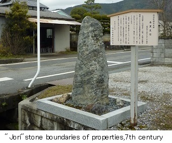 After the "Taika" political reform in 645AD, All farmland was nationalized and distributed to all the people.In order to organize the farmland, the "Jori" system was implemented, in which land was divided according to precise measurements. In addition, when the ancient capitals of Heijo in Nara and Heian in Kyoto were established, a symmetrical grid system called the "Jobo" system was adopted.Later,the nationalization and the distribution of farmland declined,and feudal manors were established under the control of temples and loyal families.There are still remains of "Jori" and "Boji" stones, which indicate the boundaries of the area at that time.
The earliest maps resulting from surveying are several maps of farmland at Todaiji Temple drawn in the middle of the 8th century,during the Nara period,which have become "Shosoin"imperial archives. Around the same time as this, Gyoki (668-749,the Buddhist priest) compiled a map of the roads throughout Japan, commonly known as the "Gyoki Map", and several types of maps still exist, but they are mere illustrations and are far from a survey map.In Tagajyo Castle, Miyagi Prefecture, which was built for the defence of the northern invaders, there is a monument like milestone that still remains, but it is not based on an accurate survey.
Although there are no noteworthy records of surveying until the 15th century, it is thought that the feudal manor estates,which was the conomic base of society, expanded and land surveying was widely practiced.
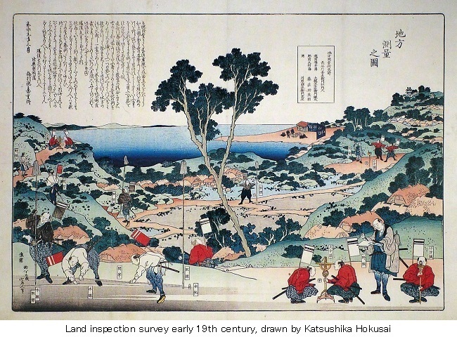
In the latter half of the 16th century, With the introduction of European culture, new surveying techniques were introduced."Kenchi", the land inspection survey was also conducted by Toyotomi Hideyoshi (1537-1598, the supreme authority).Feudal lords,"Daimyo" in various regions made and submitted county maps based on large-scale surveys, and the amount of rice production was officially recognized.At this time, a pictorial map, "Bunroku Map",local map of each coountry was created.However, at this stage, it is not believed that enough surveying was done, just enough to determine the boundaries of the countries.
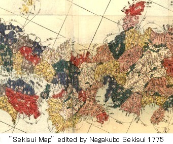 In the Edo period, from the 17th to the mid-19th century,in its early years,the Shogun Tokugawa Ieyasu(1543-1616) allocated a city to Edo, Tokyo.From the end of the 17th century to the beginning of the 18th century,"Shoho Map" and "Genroku Map" were compiled as overall maps of Japan.In the latter half of the 18th century, "Sekisui Map" was published by Nagakubo Sekisui (1717-1801,cartographer).It was the first map on which longitude and latitude were displayed.This map is almost the same in outline as today."Sekisui Map" was widely used until the Meiji Restoration. From the latter half of the 17th century, European technology became popular,and astronomical surveying and trigonometry were introduced from Europe,and were often used for civil engineering and construction.Guidebooks on surveying were also published in the form of handwritten books.
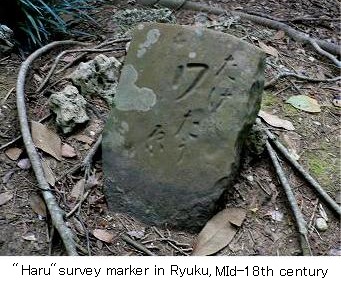 In the 18th century,surveying was widely practiced for mapping and urban expansion.At this time,the government of Edo was experiencing financial difficulties, and accurate village maps for tax collection were needed.In the middle of the 18th century, the Ryukyu dynasty conducted its own land survey in Ryuku, Okinawa, and used surveying markers called "Shirube"or"Haru" tone.These survey marker stones still remain in many places in Okinawa.
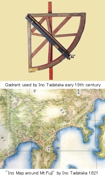 At the end of the 18th century, Takahashi Yoshitoki (1764-1804)was appointed as the chief astronomer of the government observatory and Ino Tadataka (1745-1818,surveyor,cartographer)was initiated under Takahashi.From the beginning of the 19th century, Ino led a government-sponsored topographic surveying and map-making project of the entire country for 17 years, using land surveys by traverse method with a compass and a rope, forward intersection method, and astronomical surveys.After Ino's death,Takahashi Kageyasu (1785-1829, astronomer) took over and completed the "Ino Map".
In the first half of the 19th century,the government instructed all the feudal lords in Japan to survey the borders, cities,villages,and compiled the "Tenpou Map",a map of all area. From the latter half of the 18th century to the 19th century,the Northern Islands including Sakhalin and Kuril Island were explored for defending against foreign invasions. Mogami Tokunai(1755-1836) and Kondo Jyuzo(1771-1829),Mamiya Rinzo(1780-1844) explored from Ezochi(later Hokkaido) to the Northern Islands.In the middle of the 19th century,Takeshiro Matsuura(1818-1888) surveyed throughout the whole area of Ezochi,and Ezochi came to be called Hokkaido.
2.Surveying in the early Meiji period (until around 1890)
Immediately after the Meiji Restoration in 1868, science and technology from Europe and the United States began to be actively introduced,and this included surveying technology.Japan was in urgent need of maps to improve its infrastructure as a modern nation.Surveying techniques by hired foreigners were also introduced.Although field surveying was a trial-and-error process,the foundation for modern surveying and mapping in Japan was laid during this period, and surveying engineers were trained. The organization of the government was expanded and surveying was carried out in various fields.
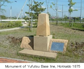 Under the guidance of James R. Wasson and Murray S. Day,who were hired by the "Kaitakushi",Hokkaido Development Office,Arai Ikunosuke(1836-1909, surveyor, ex-shogunate vassal) and Fukushi Naritoyo(1838-1922, surveyor) established the Yufutsu base line and Hakodate subsidiary base line, and full-scale triangulation survey was carried out in Hokkaido. The triangular network covered two-fifths of the total area of Hokkaido, but at this stage it was suspended due to priorities such as port surveying, and later surveying was conducted by the Hokkaido Prefectural Office following the abolition of the Kaitakushi.
In 1869,the Ministry of Civil Affairs set up the Census Department and started cadastral surveying for tax collection. In 1871,the Geographic Division was established in the Ministry of Finance and took over the duties of the Civil Affairs. "Azakirizu",cadastral map,which depicted the boundaries of towns and villages and the smallest divisions of rice fields was compiled.But in some cases,it was inaccurate because it was measured by eye or by foot.
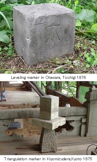 In 1871,the Surveying Division of the Ministry of Engineering was established to survey maps,and surveying techniques were introduced by hired foreigners such as McVean and Joynell from Great Britain.In 1872, 13 triangulation survey markers were installed in Tokyo, including the Fujimi Tower at Edo Castle,the current Imperial Palace and Atagoyama-hill. This is considered to be the beginning of full-scale triangulation in Japan.However,most of the surveying was done under the leadership of hired foreigners, and it was not until 1873,when the surveyor purchased a foreign-made theodolite,that Japan began to conduct its own surveying.
In 1874,the Geographical Bureau of the Ministry of the Interior was established to take over the surveying duties of the Ministry of Engineering and began triangulation of large cities,harbor cities,and military urbans,following Tokyo.In 1876, the "Great triangulation of Tokyo and its vicinities" was started, which became the basis for the first-class triangulation in later years.Precision leveling survey has been started in Tokyo Prefecture and between Tokyo and Sendai.
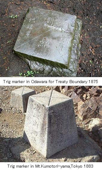 In the same year,a medium sized triangulation was carried out between Yokohama and Odawara to confirm the range of permitted activities for foreigners in the Yokohama settlement.This is known as the "Land Survey of the Kanagawa Foreigner's Treaty Boundary". Following Tokyo,Yokohama,Kyoto,and Osaka,the triangulation of Kobe,Niigata,and Nagasaki was also started.In 1878, and "Great triangulation of Tokyo and its vicinities"was expanded and renamed to "All Japan triangulation".
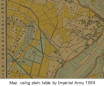 In 1874,the Imperial Army General Staff began surveying under the guidance of French military advisors,and in 1877, during the Civil War in Kyushu,the government forces struggled with inadequate maps of the Kyushu region based on the "Ino Map" and the need for accurate maps.In 1878, the Map Division and the Survey Division were established in the General Staff to create maps for military purposes,and in 1879, the Chief of the Survey Division of the General Staff, Major Kosuge Tomohiro(1832-1888), planned a nationwide surveying project and submitted his "General opinion on the survey of the whole country. However,because of the great expense involved in implementing this plan,the plan was revised and it was decided that,for the time being,the plan would be based on the plain table method.In 1881, precise triangulation survey was conducted on an experimental basis along the coast at Tokyo Bay area,and it became clear that the the plain table method could not be applied to a wide area.In 1882, the General Staff conducted a baseline survey in Sagamino,Kanagawa prefecture,afterwards second and third class triangulation in the same area.
In the same year,Tasaka Toranosuke(1850-1919), a captain of engineers in the General Staff,returned to Japan after learning the surveying method in Germany and systematized the method starting from first class to lower class triangulation. In 1883, the General Staff started first-class triangulation and first-class leveling. The base line was set at Mikatahara in Shizuoka Prefecture,following Sagamino the previous year. In 1884,a temporary Geodetic Datum Origin was placed in Azabu,Tokyo.
In 1886, the Geographical Bureau of the Ministry of the Interior was integrated and absorbed into the Survey Bureau of the Imperial Army General Staff,leaving only astronomical observations and meteorological operations of the Geographical Bureau.It was later transferred to the Ministry of Education and the Geographical Bureau was abolished in 1891.
3.Surveying from the late Meiji era to the end of World War II
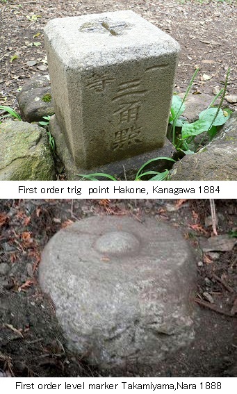 In 1888,"Rikuchi-sokuryoubu",the Land Survey Department of the Army General Staff was established. As a result,the surveying operations were integrated into this organization, and the first director was Engineer Colonel Kosuge Tomohiro.Full-scale triangulation and leveling surveys were conducted throughout the country to produce accurate topographic maps.The Land Survey Department continued until the end of World War II in 1945. In 1901, the Department's internal regulations for the draft of the Triangulation Method were established.
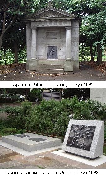 In 1891,Japanese Datum of Leveling was established at Miyakezaka,Tokyo,and the following year,the Japanese Geodetic Datum Origin was established at the Tokyo Astronomical Observatory in Azabu,Tokyo.In 1902, the first triangulation work in Hokkaido was started. This survey had been started in 1873 by the "Kaitakushi"Hokkaido Development Office, but it was fundamentally redone by the Land Survey Department using a uniform nationwide survey method.In 1906, after the Russo-Japanese War,the border demarcation of Sakhalin began and continued until the following year.The Land Survey Department played a major role in this project.In the same year,the survey of Okinawa was started, and in the following year, the survey of the Korean Peninsula has begun.Triangulation had already been started in some areas before the establishment of the Land Survey Department,but it was almost completed by the end of the Meiji era, except for Hokkaido,Okinawa and other overseas territories.
The "Survey Marker Management Regulation" was enacted to protect the survey makers from destruction or movement and this regulation remained in effect until 1949.In 1896,the triangulation markers were made of granite from Shodoshima Island,and in 1900, the installation of a small marker further down the base of first order triangulation marker was started.In 1902,an instruction was issued to all prefectures to protect survey markers.In 1889, based on the "Ino Map" and "Tenpou Map",the compilation of map at a scale of 1:200,000 maps was started.In 1895,the production of topographic maps of 1:50,000 started in earnest from maps of 1:20,000,which had been called provisional maps of a part of the country,and in 1910,the production of topographic maps of 1:25,000 started.
In 1913, the first class triangulation and level survey of the whole country was completed.In 1918, the Japanese Geodetic Datum Origin was revised and the correction of survey results began.In 1920, the survey of the Southern Islands of Pacific,which became a Japanese mandatory territory after World War I,began.In 1923,the Great Kanto Earthquake occurred,and emergency mapping and damage surveying were started.In 1924,the International Ellipsoid was decided at the Universal Geodetic Congress in Madrid,and the results of Hayford's calculation were adopted,but Japan continued to use Bessel's ellipsoid.In 1925,the publication of topographic maps of the entire country at a scale of 1:50,000 was completed.
In 1931,the survey of Manchuria,northeastern part of China began.In 1937,as the wartime atmosphere deepened,land and buildings that needed to be kept secret for national defense were falsified and redrawn on maps,and map sales were suspended.In 1941,the sale of maps was stopped.In 1944,the Land Surveying Department was evacuated to Matsumoto,Nagano prefecture.In 1945, the head office of the Land Survey Department in Miyakezaka,Tokyo was destroyed by an air raid.With the end of the war, the Land Survey Department of the Army was abolished.
4.Surveying after World War II
At the end of the war, the Land Survey Department of the Army General Staff was replaced by the"Chiri-chosasho",the Geographical Survey Institute of the Ministry of the Interior.At the same time, surveying was shifted from military purposes to those directly related to national development and people's daily lives.In response to the request of the Allied Forces,the inquiry of reference points of triangulation markers and postwar restoration projects were carried out.Land surveying, mapping, and research and development were also implemented.
In 1949, the Survey Act was enacted,which established surveying standards and a surveying system,and a basic long-term plan for surveying was formulated every ten years starting in 1953.It covers a wide range of activities such as geographic and geodetic surveying, mapping,and geographic research.The Survey Act defines basic surveying by the national government and public surveying by local governments as well as the linkage between the two.In 1960,the Geographical Survey Institute was renamed as the "Kokudo-chiriin", but the English name remained the same.In Okinawa under the U.S. military rule,the Ryukyu government enacted the Ryukyu Survey Act in 1959,which was continued until the island returned to Japan in 1972.
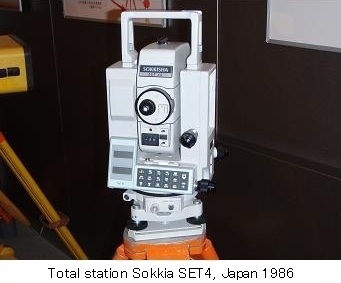 After the war, a nationwide geodetic survey was started using new technologies for geomagnetism and gravity,which represent the properties of the earth,in addition to triangulation and leveling. In terms of surveying technology, aerial photogrammetry was introduced in earnest, and with the development of lightwave rangefinders, surveying became more accurate and efficient, and surveying methods shifted from triangulation to trilateration surveying.
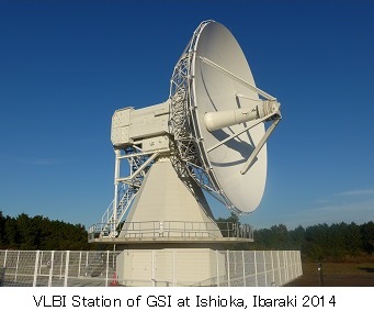 Since the 1980's, space communication technology such as VLBI (Very Long Baseline Interferometry) and GNSS (Global Navigation Satellite System) has been used,and with the development of information technology, the field of surveying and mapping has been digitized. In 2001,the Japanese Geodetic System was replaced by the World Geodetic System,an international geodetic standard that is compatible with the entire globe.In addition to reflecting the results of surveying in maps, the system also plays an important role in disaster prevention,such as earthquake and tsunami prediction,through the cooperation of countries around the world, relevant ministries and agencies, and local governments.
Based on the partial revision of the Survey Act in 2007 and the enactment of the Basic Act on the Promotion of Utilization of Geospatial Information,a long-term plan for the 10-year period from 2009 to 2018 has been newly formulated.It shows the direction to contribute to the realization of a new society through the use of geospatial information. Geospatial information includes not only accurate maps and the location of specific points, but also all kinds of information such as photographs and administrative statistics, and aims to create an environment where location and geographic information can be easily shared by anyone, anytime, anywhere.